
BOSHEAR
OR
Enumeration updated by David
and Martha Montgomery
Click on the names above to send an
e-mail or use the email address
GPS Coordinates: Lat: 35° 09΄ 27˝N, Lon: 87°
34΄ 51˝W
LOCATION:
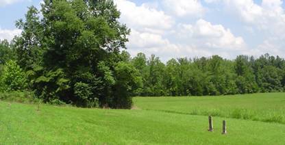
From the Westpoint, Tennessee area, turn off onto Collinwood Rd./California
Branch Rd. and travel for approximately 3.3 miles. Turn right onto the Jack
Nelson/Johnson Hollow Rd., a dirt road. Travel approximately .3 miles to the
cemetery on the right of the road. It was the former Floyd Nelson farm now
owned by Jack Nelson. Mr. Nelson presently takes care of the cemetery. The
property was formerly owned by the Boshear family. This cemetery is no longer
in use and there are many unmarked graves here. This cemetery is on the
Wayne/Lawrence County line. There are 2 graves in the Nelson yard that once
were marked with field stones, however those grave locations have been lost.
The two graves were reported to be Tuckers, a father and son. According to
sources, the son was killed in the battle of Shiloh. The Tuckers were the
original owners of this land, later owned by the Boshears, Gallahers, and
Nelsons. This farm was in Lawrence County until Mr. Gallaher owned it and he
had it changed to Wayne County in order to keep from paying railroad taxes,
according to legend by the late Floyd Nelson.
Hollis, William; b. 28 Nov 1802, d. 08 Sep 1875, husband of H.J.Luker, W.J.; b. 12 Nov 1826, d. 09 June 1864, husband of M.L.Luker, Martha E.; b. 03 Dec 1830, d. 02 Jun 1898, wife of James, daughter of William Hollis*McCrory, Mary E.; b. 27 Oct 1875, d. 27 Dec 1875, daughter of C.H. and M.M.
* This stone was in
the attic in Floyd Nelson's home. C.H. McCrory bought the tombstone for his
daughter's grave, but when the stone arrived, he had forgotten the location of
the grave and never erected it. The home is now owned by Jack Nelson and the
headstone still remains in the attic of the home in the original shipping
crate.